AngelPilot Software
AngelPilot is a Macintosh application which facilitates the use of charts and satellite imagery to assist the small boat navigator with pilotage. It has two components:
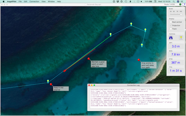
1. A chart plotter specifically designed for pilotage, with the ability to add and display detailed notes, as well as the usual navigational aids (waypoints and routes). AngelPilot reads BSB(KAP), GeoTIFF, and the excellent Antares charts.
2. Chart creator: Allows the user to select satellite images and save them for loading into the chart plotter when offline.
AngelPilot can obtain navigational information from a variety of sources, and is fully compatible with the latest SignalK technology, such as iKommunicate
It can also be used to georeference certain types of chart or image.
Further information is available via the support page here